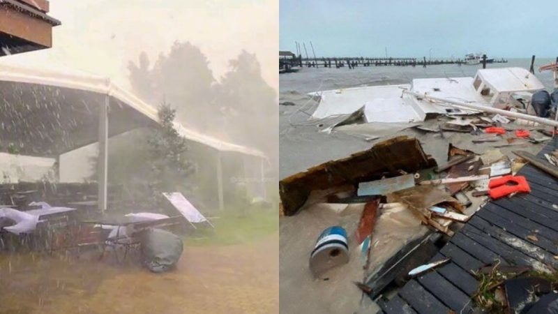
A hurricane is barrelling towards the panhandle of the United States and officials are on high alert. Being dubbed Hurricane Helene, it is said to make landfall in Florida on the eve of Thursday, September 26, 2024. The storm is gaining intensity as it progresses towards Florida. Officials have also asked many residents to evacuate. Here are all of the other important details that you would need to know about this particular hurricane.
Hurricane Helene: All You Need To Know About This Storm
🚨🇲🇽HURRICANE HELENE UPDATE
Quintana Roo, Mexico:
– Massive flood and Material damage reported
– Cancun hotel area severely affectedNo loss of life reported
Assessment and recovery efforts underway#HurricaneHelene #QuintanaRoo #Cancun #Hurricane #mexico pic.twitter.com/6vmlMY0qaV
— Berkan Yılmaz (@Berk04790) September 26, 2024
According to an article which was recently published by Reuters, Hurricane Helene is expected to pour a whopping 15 inches of rain in some areas after making landfall. It is feared that this will end up causing flash flooding as well as urban flooding.
The hurricane is now being categorised as a Category 4 hurricane as it increases in intensity. Officials have now ordered evacuations on the Gulf Coast of Florida. Areas like Pinellas County, Sarasota and Charlotte County. A number of schools across these regions have announced closure on account of the storms.
Storm Helene ‘unsurvivable’ 6 Meter surge from national Hurricane Center this September 2024 is really remarkable when it comes to loosing habitat and how often can we rebuild in a finite world? pic.twitter.com/6XJsaZsNtg
— Thomas Reis (@peakaustria) September 26, 2024
It has already wreaked havoc across the Gulf Of Mexico. Many Netizens have shared harrowing pictures and videos of the storm. It became more powerful owing to the warm water and became even more intense. Now, it is heading towards Florida.
Also Read: Hurricane John Hits Mexico, 3 Dead; Travel Advisory Issued Amid Flooding, Landslides & Heavy Rains
Other Important Details To Know About This Particular Storm
This is how the strong side eye wall of near category 5 Hurricane Ian looked with the wind direction off the water with double digit storm surge. This is how the conditions could look in the wrong side of Hurricane Helene as well. Definitely a force to be reckoned with! I would… pic.twitter.com/ztF9eYAo7D
— Reed Timmer, PhD (@ReedTimmerUSA) September 24, 2024
If reports are to go by, the winds of this hurricane are around 256 kilometres per hour. Some officials were even heard saying that it could be worse than anything they have previously dealt with. What is more, officials are expecting what they’re calling a “wall of water.”
In addition to Florida, people in Georgia and Alabama are also going to be severely affected. As of now, there hasn’t been much damage to infrastructure or any loss of lives and it is hoped that everyone remains safe.
Also Read: From Hurricane Idalia To LGBT Travel Warning, Here’s All About Canada’s New US Travel Advisory
Have you ever been in such an intense storm? How did you manage to get by? Let us know in the comments section below!
Cover Image Credits: @CaramelRhapsody and @Berk0470/X (Formerly, Twitter)
For more such snackable content, interesting discoveries and the latest updates on food, travel and experiences in your city, download the Curly Tales App. Download HERE.
First Published: September 26, 2024 5:49 PM


