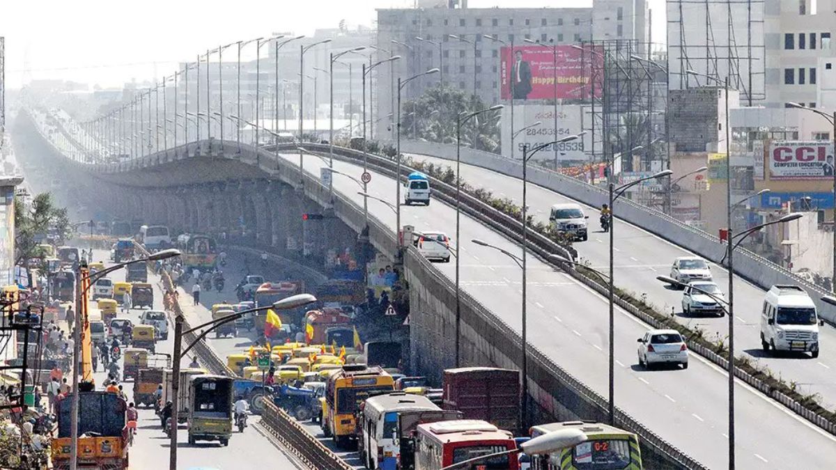
Bengaluru, India’s Silicon Valley, has long grappled with the bane of urban living: traffic congestion. In a bold move to alleviate this perennial issue, the Karnataka government has announced plans to construct 17 elevated corridors across the city. This ambitious project, estimated to cost a staggering ₹12,000 crore, aims to transform 100 kilometres of roads into signal-free stretches.
Karnataka Government To Construct 17 Elevated Corridors Across City
#Bengaluru Metro: Rs 15,611 Crore Project Advances With Public Investment Board’s Approval. The central government’s Public Investment Board has recently cleared 44.65 km Bengaluru Metro’s Phase-3 expansion project with 2 elevated corridors & a total of 31 metro stations@cbdhage pic.twitter.com/PWxObOVFfd
— India’s Infrastructure (@INDIASPROG98425) June 25, 2024
The brainchild behind this initiative is Karnataka Deputy Chief Minister and Bengaluru Development Minister D K Shivakumar. Recognising the crippling impact of traffic on the city’s economy and quality of life, Shivakumar has positioned this project as a cornerstone of the government’s urban development strategy.
The Bruhat Bengaluru Mahanagara Palike (BBMP) has already undertaken a comprehensive traffic study to identify the most congested areas and prioritise the construction of these elevated corridors. The BBMP is expected to release a detailed plan in the coming months, although they have yet to finalize the exact locations.
Also Read: Bengaluru’s Online Auto Fares Continue To Soar Despite High Court Ruling On Capping Prices
To Be Implemented In Phases
🚨Bengaluru to get 17 elevated corridors to make 100 km of roads signal-free. The total cost of the project is likely to be ₹12,000 cr.
GoK aims to complete the project within the next 4 years. #Bangalore #Bengaluru #BrandBengaluru #Road #Project #Karnataka #Traffic pic.twitter.com/OqoX5toaIr
— Brand Bengaluru (@brandBLR) July 28, 2024
One of the most anticipated corridors will stretch 23 kilometres from K R Puram to Goraguntepalya. It will traverse key thoroughfares such as Old Madras Road, Ulsoor Lake, Jayamahal Road, Mekhri Circle, and Yeshwanthpur. This stretch, notorious for its snarling traffic, is expected to benefit immensely from the elevated corridor.
In addition to this major artery, the government plans to extend the existing Ejipura flyover to Hosur Road. This is a crucial link for commuters travelling to and from the city’s southern suburbs. Another proposed flyover will connect Anand Rao Circle to K R Circle. This will ease traffic flow in the heart of the city. To further improve connectivity in the central business district, a new flyover from Hudson Circle to Minerva Circle is also on the cards.
The project is expected to be implemented in phases, with four to five corridors being constructed each year over the next four years. While the government has outlined its vision, the funding mechanism for this massive undertaking remains unclear. Experts suggest exploring a combination of public-private partnerships and government funding to meet the project’s financial requirements.
Beyond the elevated corridors, the BBMP is also focusing on improving the city’s road infrastructure at ground level. The recently launched ‘Raste Gundi Gamana’ (Fix Pothole) mobile app is a step in this direction. By empowering citizens to report potholes, the BBMP aims to expedite repair work and improve road conditions.
Cover Image Courtesy:@raghavanrv_it /X (Formerly, Twitter)
For more such snackable content, interesting discoveries and the latest updates on food, travel and experiences in your city, download the Curly Tales App. Download HERE. First Published: July 29, 2024 4:49 PM


